A view of Blackcombe Mountain from Whistler Village.
 Stopped on the side of the road.
 Mountain vistas.
Duffy Lake is still frozen.
 A view of Blackcombe Mountain from Whistler Village.Stopped on the side of the road.Mountain vistas.
 An Avalanche that had been cleared the day before.
 Just one of the many steep grades on this road.

 A special view from Dutchess as she is parked over looking the Fraser River.


From Vernon we traveled through Kamloops wanting to spend a couple of days at Juniper Beach Provincial Park near Walhachin but have found out that many of the parks out of the Lower Mainland and Okanagan Valley do not open until May. So we traveled onto Cache Creek for a couple of nights. From there we took highway 99 through the Marble Canyon Provincial Park to Lillooet.

Two ninety degree sharp turns to negotiate under this railway bridge, with very little room to spare. The road was narrow but mostly in very good condition.


Wonderful views of the valley with the muddy Fraser River.

Any flat area of land is irrigated to grow grass for hay.

Walhachin was a thriving community in the mid 1800’s but today other than farmland, the bridge over the Thompson River and the remnants of the old pump house and the resident birds nesting on the top of the bridge, that is all that remains to be seen.


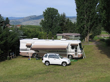
Anita in her back garden

We had a wonderful five nights at Anita’s before setting off on our summer travels in Dutchess and Granny