 A view of Blackcombe Mountain from Whistler Village.
 Stopped on the side of the road.
 Mountain vistas.
Duffy Lake is still frozen.

In 2002 we had a wonderful trip across Canada in a VW Westfalia camper 'Adolph'. Our 4 month trip took us to all 10 provinces, covering about 24,000 kms.The chance to visit family and friends as well as the many National Parks and Canadian Historical Sites convinced us that we must plan to do this trip again. This year our dream is coming true. ...Note: Left click a photo to enlarge...
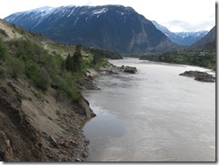
 A special view from Dutchess as she is parked over looking the Fraser River.
 Lillooet is a town built on both sides of the Fraser River with the main railway link from Northern BC to Vancouver passing through town. The glory days of Lillooet were in the mid to late eighteen hundreds with a population of over 15,000 people most of them arriving with the Gold Rush. At that time it was the second largest town/city west of Chicago. The old suspension bridge, built in 1913, has been maintained and is now available for cycling and walking across the river.

From Vernon we traveled through Kamloops wanting to spend a couple of days at Juniper Beach Provincial Park near Walhachin but have found out that many of the parks out of the Lower Mainland and Okanagan Valley do not open until May. So we traveled onto Cache Creek for a couple of nights. From there we took highway 99 through the Marble Canyon Provincial Park to Lillooet.
Two ninety degree sharp turns to negotiate under this railway bridge, with very little room to spare. The road was narrow but mostly in very good condition.
Wonderful views of the valley with the muddy Fraser River.
Any flat area of land is irrigated to grow grass for hay.
Walhachin was a thriving community in the mid 1800’s but today other than farmland, the bridge over the Thompson River and the remnants of the old pump house and the resident birds nesting on the top of the bridge, that is all that remains to be seen.
On the drive down Sliver Star Mountain we stopped to look out over south east Vernon and Kalamalka Lake.
This view over looks Vernon in the valley with Kalamalka Lake in the distance on the left and Okanagan Lake in the middle of the picture and the water to the right is Swan Lake.
A closer view of down town Vernon with Okanagan Lake in the back ground and Swan lake in the front. Herongate is down the hill in the trees to the left of the picture.
In Vernon we had a little rain and thought that up on Silver Star Mountain there would have been some fresh snow. The ski season is finished and everything was closed up tight, except for one restaurant and bar. So we drove Granny up the mountain and discovered only a light sprinkle of grainy snow on top of the old dirty winter snow.
On Friday night Anita had a pot luck dinner party for twelve.
Above: Anita, Pat, Darleen, John, Nancy, Bob, and Carolyn
Below: Glenda, Ken, Kath, Bob, Anita, Pat and Darleen
It was wonderful to see so many Vernon friends all in one swoop, with only Brian and Marilyn and Steve and Anne missing.
